Kamikochi
The popular valley of the Hida Mountains
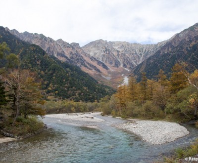
Kamikochi is a 15-km forested valley located along the Azusa River, in the Northern Japan Alps of Nagano prefecture. This scenic area offers lovely hiking trails that can be walked in one day, embellished with wonderful landscapes in the spring and fall. Designated part of the Chubu Sangaku National Park, it is unfortunately crowded due to its popularity in peak tourist seasons.
The Kamikochi plateau is between 1,400 and 1,600 meters high, with peaks reaching more than 3,000 meters in the surrounding mountainous massifs. The first person who reached the region’s peaks was the Buddhist priest Banryu (1786-1840), from a Buddhism branch preaching for long retreats in the mountains.
Then, the mountain climber Walter Weston (1861-1940) developed climbing in Japan and advocated for this beautiful site. He insisted on the essential conservation of this natural area, which belongs today to the Chubu Sangaku National Park. A commemorative plaque stands in his honor in the park.
The valley is also the perfect departure place for longer hikes. It allows hikers to join famous peaks of the region:
- Yake-dake (焼岳), about 5 hours hiking
- Hotaka-dake (穂高岳), between 8 and 9 hours hiking
- Yariga-take (槍ヶ岳), about 10 hours hiking

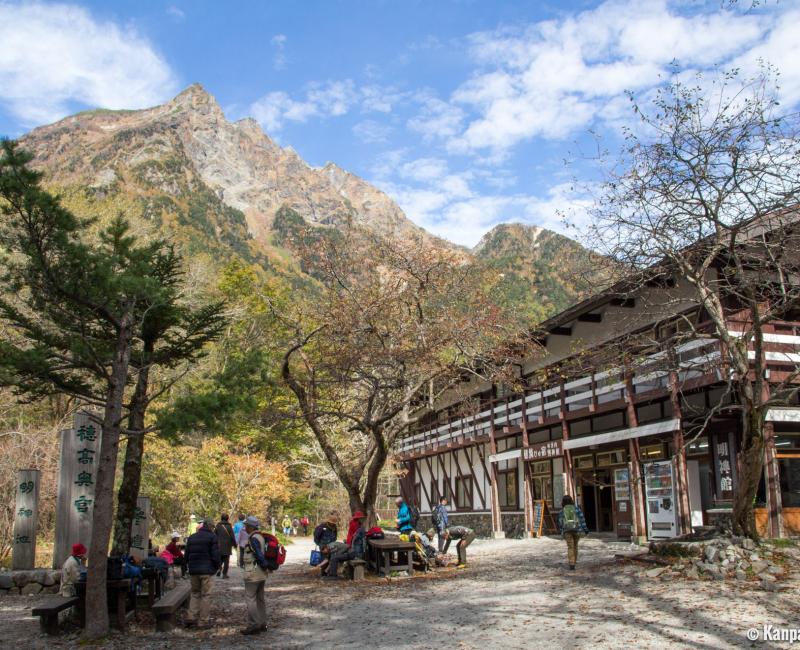
To enjoy the site itself, you can sleep in one of the numerous shelters located all along the water stream. Some are delightful, such as the Tokusawa-en. Some spaces were developed for camping and therefore guarantee waking up in a gorgeous setting. However, the main path is absolutely doable in one day.
The bus terminal located in the middle of the easiest path usually arrives at Kamikochi. It is advised to start at the Kappa-bashi Bridge very close by. Arriving during the first hours of the day, as soon as the sun rises, enables you to avoid the crowds and therefore to fully enjoy the view of the surroundings mountains. The name of the place is linked to the Kappa legend about small monsters of Japanese mythology living on the riverbanks. Furthermore, you can find small statues and figures of these monsters in the form of small frogmen with holes in their heads that contain water.
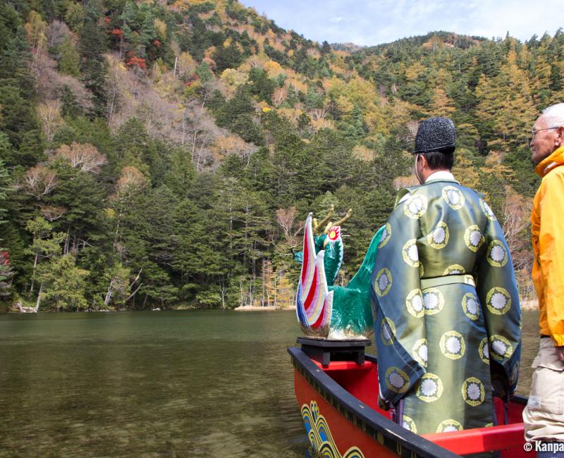
The trail continues by going up or down Azusa River. The walk path leading to the beginning of the river by the left bank is a simple 45-minute walk in the forest, while the north side, up to a 70-minute walk, offers more diverse passages. Both lead the hikers to the bridge and to Myojin Pond. Located just behind the pond is the small Hotaka Shrine, which deserves to be discovered, even though the entrance fee is ¥300 (~US$1.95). The 8th of October each year, a Shinto ceremony takes place on small boats to thank the gods for their protection. Right next to it, there is a small restaurant offering grilled fish and soba noodles.

The part upstream toward Tokusawa, about 60 minutes farther, is less busy. The riverbanks are quieter and more accessible, offering calm and charming breaks in the heart of nature. Favoring this area instead of the promenade in the south of Kappa-bashi is a good idea when there are too many travelers.
Downstream of the bus terminal, Tashiro Pond is one of the most pleasant places in Kamikochi. However, it possesses less interesting sites than its upstream counterpart. The north and south riverbanks, leading to the lake in 50 minutes, offer a beautiful walk, always along Azusa-gawa. Picnic tables are settled midway on the south side of the river, and souvenir shops sell good cakes and dairy products typical of the region.
Attention to hiking lovers: This trail is almost completely flat. It is wise to think of longer excursions to really enjoy the peaks of the Japanese Alps. Kamikochi is therefore a base camp, quiet enough in the night and in the early morning without tourists. The high number of international and local tourists in the summertime is indeed a critique of this area.

